
To record the construction of existing buildings for the purpose of producing as-built plans and elevations.

Measured Building Survey
If there are no accurate plans and elevations for a building we can carry out a measured survey and produce as-built plans and elevations in 2D or 3D CAD format prior to preparing designs for alterations or repairs.
Accurate plans and elevations are essential for a successful building project. The provision of accurate drawings feeds into:
- Accurate pricing for the project works – a contractor or quantity surveyor has accurate information to work from.
- Preventing delays on site – if a contractor finds the size, layout and position of building elements on site is different from the plans, costly delays can be caused.
- Prefabricated components being the correct size when they reach site, ensuring the building process runs smoothly.
Measured building survey techniques
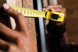
We use a variety of tools to carry out your measured building survey, from the basic clipboard, pencil, steel tape measure and camera to more sophisticated equipment.
Laser distance measure: We use a Leica Disto laser measure to record very accurate internal and external measurements of the building. The Bluetooth capability of this equipment allows us to link the laser measure to our handheld devices running software dedicated to producing building layouts in super quick time, reducing our survey time and saving you money.
ZIP level: Our Zip Level Pro-2000 is used to record relative heights inside and outside of the building. A Zip level is a bubble free pressurised altimeter capable of accurate and repeatable measurements.
What is a measured building survey?
A measured building survey is the accurate recording of the interior and exterior dimensions and levels of the building, showing all of the architectural and structural elements and features. Accurate plans and elevations are essential when planning work to a building and form part of scaled construction drawings.
We generally undertake a measured survey as part of our reclad design process.
Work with the professionals
We have extensive experience of other people’s mistakes from our hundreds of defective building investigations.
The evidence of the last fifteen to twenty years of the NZ construction industry’s mistakes leads us to one fundamental conclusion: It is better to try and get it right first time rather than re-visit the mistakes later at considerable cost to building owners, tenants, designers, contractors, sub-contractors, councils, government, insurers and lenders.
Questions about our services?
We know there is commonly asked questions about the design process and choosing, engaging and working with a building consultancy business.